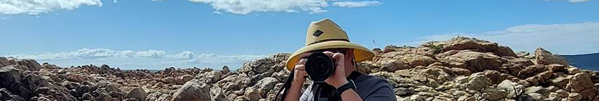
After several years of talk and very little action, Denise Cooper and David Flannery are now embarking on an epic journey to travel the length of the Richmond River from its origins at the junction of the Richmond Range and McPherson Range West of Mount Lindesay, to where it exits into the Pacific Ocean at Ballina.
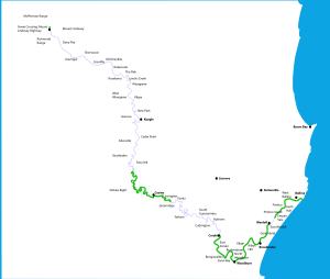
Map updated Jan 7, 2024
According to Wikipedia the Richmond River flows generally South East “descending 256 metres (840 ft) over its 237 kilometres (147 mi) course”, but the true origin of the first streams that form the Richmond River is at an elevation of approximately 750m, at the junction of the Richmond and McPherson Ranges.
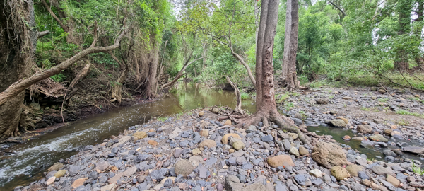
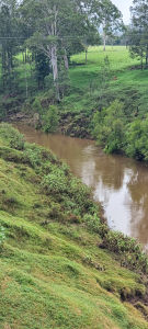
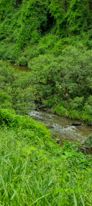
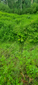
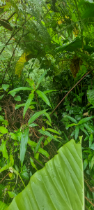
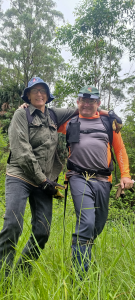
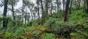
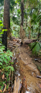
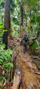
The journey began on January 6, 2024 where we hacked our way from the point where the Richmond River trickles under the Mount Lindsay highway through the dense undergrowth of lantana, raspberry, tobacco trees and more to reach the origin of the River at the Queensland-New South Wales border, approximately 1.5 kilometres North of “Yowie Crossing“.
Jan 6, 2024 – TRECKING TO THE SUMMIT
( Click “+” to expand, or “-” to collapse =======>)
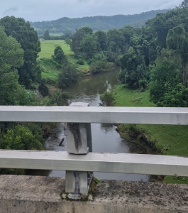
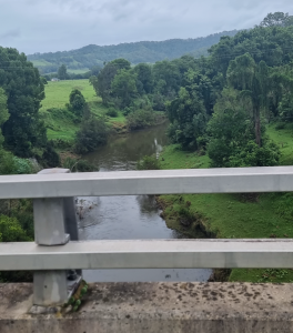
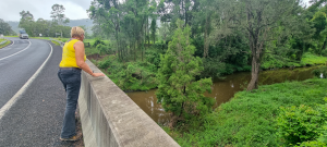
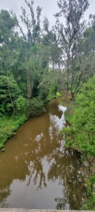
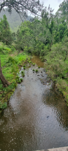
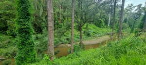
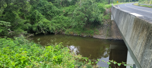
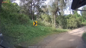
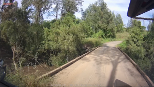
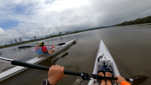
On the drive out to the start of the hike, we stopped at a bridge just South of Kyogle, and then at several other bridges that cross the Richmond River on the Summerland Way.

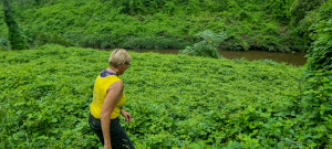
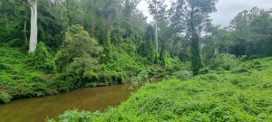
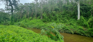
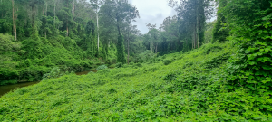
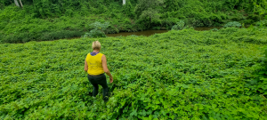
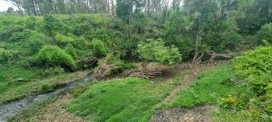
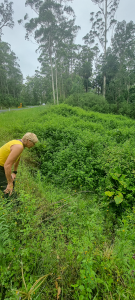
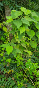
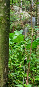
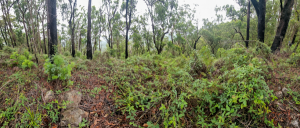
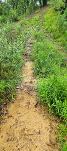
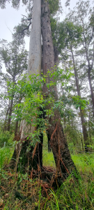
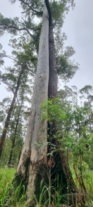
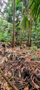
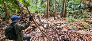
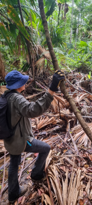
The treck started where the river passes under the Mount Lindsay Highway, and we were immediately greeted by very dense undergrowth that resulted in very slow going. We were then very surprised to encounter a state forest bounday fence in the middle of the forest. The clear path adjacent to the boundary fence greatly sped up our progress and so we decided to climb right to the peak, above the first marked definition of the Richmond River.
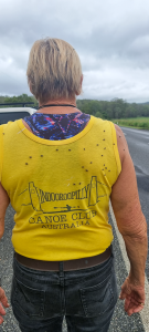
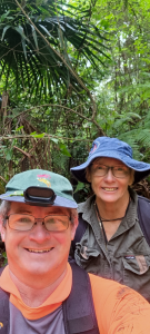
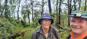
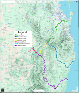
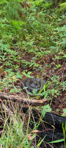
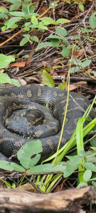
At the summit, where the Richmond Range intersects with the Queensland Border at the McPherson Range, we stopped for lunch and pondered where the water on the other sides of the ranges ends up. Some homework was required, but this shows that the North side feeds to the Logan River directly, while the West side feed to the Clarence River via serveral Creeks. We also met one of the locals.
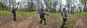
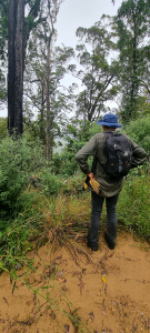
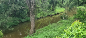
When we got back to the Mount Lindsay Highway, we had to take a look at what we were in for… Lantana, Lantana, Lantana & other prickly customers… but after a few false starts we did find a path into the jungle and down to join the River again. Still only a large step across, but destined for greatness.

April 1, 2024 – Fairy Hill – Casino – Irvington
( Click “+” to expand, or “-” to collapse =======>)
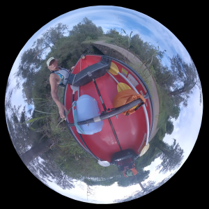
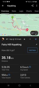
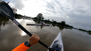
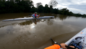
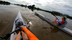
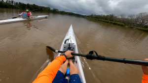
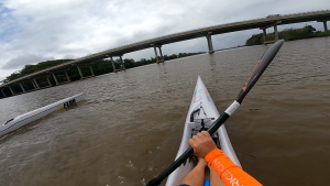
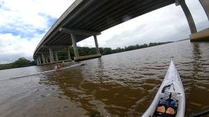
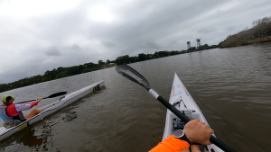
Our original plan was to take the red bathtub (a circa 1990 plastic Coleman Canoe) from Droneys Bridge Rd Fairy Hill and paddle to the Casino boat ramp, but as we fuelled up at the bakery in Casino and prepared for the day a local fisherman told us about the public river access at Irvington Warf Rd, Irvington. So off we went to check it out, and in our wisdom decided that an extra 7 km (which turned out to be 12 km by River) of scrambling/scraping over rocks and weirs, limbo under a footbridge and fallen tree and avoiding (or not avoiding) submerged trees was a brilliant idea.
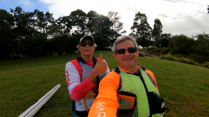
Our starting point was 23km up river from Casino, at the Droneys Bridge Rd river crossing. At this point the river is about 10m across from bank-to-bank with quite steep sides. With a sturdy rope attached to the red bathtub, David belayed it down the steep bank while Coops guided us safely down to the waters edge. Embarking was a smooth affair as the bridge had a handly timber sleeper parallel with the water, just at the right height for safely loading up and pushing off.

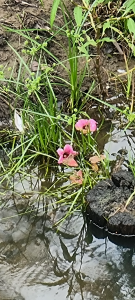
The windy river course took us through some really beautiful landscape, and the current helped keep us ticking along at a decent pace, but as the river widened and we got closer to Casino the water backed up and slowed to the point of really not moving at all – and the journey became a slog. Bathtubs don’t go fast.
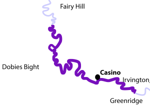
From Droneys Bridge Rd to Casino Boat ramp was about 23km. The first 20 k’s when by pretty quickly, but the last three took forever. We took a break for some food and rest at the boat ramp, talking canoes with the locals (as you do when you are a crazy paddler)… then felt 20 again and hit the water to finish the journey. Total distance is approximately 35km, but these last 12 k’s were pretty wild.
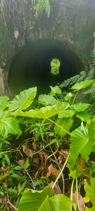
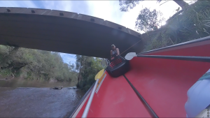
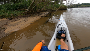
First challenge was portage past the weir. A bit rocky & bumpy with lots of trip hazzards, but no big dramas here. The water ahead, however, was full of debris, rocks, quick runs and plenty of opportunity for things to go wrong.
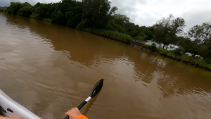
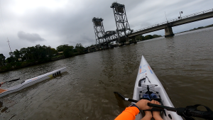
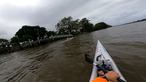
March 17, 2024 – CORAKI TO WARDELL
( Click “+” to expand, or “-” to collapse =======>)
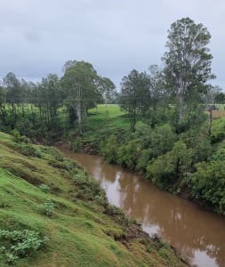
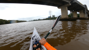
This stretch of the Richmond river is wide easy paddling, but is also the area most severely affected by the 2022 Northern Rivers Floods, which devistated the entire region destroying property, lives and livelihood – but from this has come some very strong bonds of friendship and community and the towns along the river are again starting to flourish.


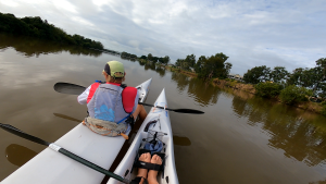

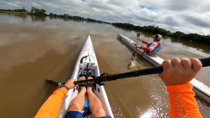
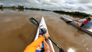
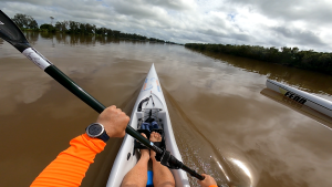
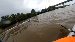
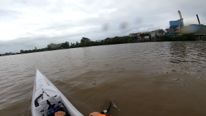
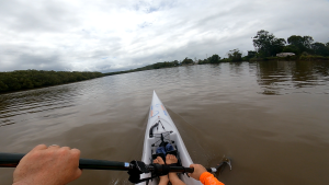
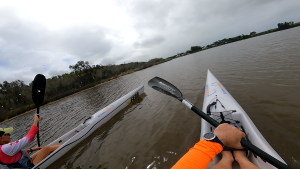
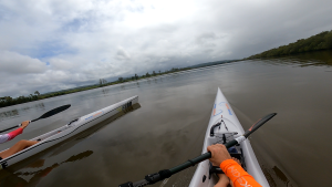
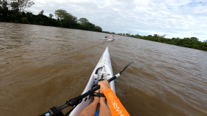
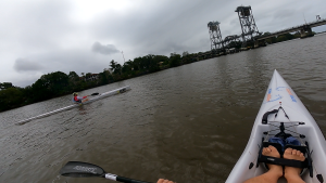
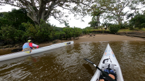
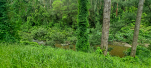
Distance is approximately 38km by road through Woodburn, which generally follows the river, however, by the river we ended up paddling just shy of 45km. The brown water seemed to go on forever… as the countryside drifted leasurely by. Lots of vines entangled the trees on the riverbanks, like huge green castle walls providing privacy to the cows beyond. We did manage to set every farm dog barking for the entire stretch of the river.
Thanks to great company and an emergency stash of red frogs and dates, we made it to Wardell just in time for a cold Beer. Cheers Cheryl & Bonnie – you made our day.
Lots of reminiscing along the way, as Denise spent half a decade living along this stretch of the river. We even took a detour past one of her old places on the way back to do the car-shuffle.